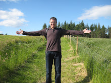
 Blue Trail Is Final Trek Down Mapped By GPS (click to see bigger image)
For a second weekend in a row, managed to make it up into the mountains and onto the snow. This weekend's activity: snow shoeing. Now I've had snow shoe's for a few years, but I've only managed to use them a measly two times before. So, they still needed a proper breaking in. Luckily, we now have a sort of "snow shoe crew". With that, we had been making plans to get out there for a workout in the snow and this past weekend we made it.
Leaving a cold, cloudy, and depressing Tri-Cities, we made our way eastward to the Blue Mountains of southeastern Washington, by way of Dayton. This is a familiar and favorite drive of mine, although most of my experience of the drive is during the summer when I'm fly fishin' the Touchet.
 The Fellowship (sorry to get all nerdy!)
So we made our way to a Sno Park area just before the Bluewood Ski Resort. Here we followed a groomed trail (Forest Service Road) into the woods. This is where our epic journey began...our Fellowship of the Snow Shoe.
 The Infamous Orange Gloves
We were graced to have some really excellent weather. Once we got up into the mountains, the gloominess of the weather below gave way to some really nice and sunny weather. We clearly observed a temperature inversion on this trip. The weather seemed to get better the higher up we went.
We hiked a mile or so along the groomed trail. On this trail, there wasn't too much need for the snow shoes since the snow was compact and hard. To really feel the benefits of the snow shoes you have to go off-trail. We ultimately decided to go off trail and head up a ridge to see what we could see.
 Photo Ops

 Ready To Hit The Trail Again
We booked it up and at the top we were greeted by an excellent view down into some valleys (one of which is called Green Fly Canyon according to Google Earth). There was also another groomed trail up here. We had a quick break here, had snacks, and snapped some photos. We then continued on the trail/road west-southwest. We talked about how we were Lords-of-the-Rings-ish with our crew hiking through the wilds of WA. Had the hardest time trying to remember the Lord of the Rings theme song, too. We eventually caught back up to the original trail we were on.
 The Misty Valley
We booked it up and at the top we were greeted by an excellent view down into some valleys (one of which is called Green Fly Canyon according to Google Earth). There was also another groomed trail up here. We had a quick break here, had snacks, and snapped some photos. We then continued on the trail/road west-southwest. We talked about how we were Lords-of-the-Rings-ish with our crew hiking through the wilds of WA. Had the hardest time trying to remember the Lord of the Rings theme song, too. We eventually caught back up to the original trail we were on.
 Lunch
LunchThis is where we heard/saw our first fellow snow shoe-ers of the day. They were a ridge away from us and they were a big group (about 14 or so). They walked by and we waved at eachother. We then decided to start heading down (I used my iPhone's gps to mark this final descent). This was a cool part of the trip because we were making our own path (no groomed trails), and it was also downhill most of the way.
Here we decided to head back along the ridge-line trail and see where it went. Nic also ate a big chunk of snow. We approached a "Road Closed" sign and decided to break for a quick lunch.
 Jammin' Downhill
 Trying Not To Eat It
 Cyrus Skiing Down
We didn't know exactly where we were at this point, but we had an idea. Most of the time, we could catch glimpses of the Bluewood ski lifts. After a while, we then saw and "heard" the paved road. So, we were lucky and happed the ridge which just happened to drop us off fairly close to our vehicles.
All in all we had a pretty good workout. This will hopefully be the beginning of many more adventures in the Blues.
Notes:- Trip Distance: 4.16 miles
- Starting Elevation: 4265 feet
- Lunch Break Elevation: 5085 feet
 Is This A Corgi?
 Galatoire's & Bourbon


